Saturday, September 17 (continued)
We left the park from its northwest exit and arrived in a small town called Silver Gate, which featured a short strip with a few small motels offering rooms and cabins, some shops, and a couple of bars. It was a much more sensible and worthy place to support visitors at the edge of the park. We ate a lunch in the diner. While working on our food, our waitress (and co-owner of the place) ran outside with a small radio in hand. She was talking back to someone else about a helicopter in the air and saying, “Well, the rangers didn’t call us.” She explained to her patrons that she is an EMS provider and member of the local search and rescue group. She was anxious at the possibility of being deployed, but mused that the rangers in the helicopter may have just been looking for some hunters who wandered into the park. “If you’re hunting at the edge of the Yellowstone, you need to know where the boundaries are,” she said with more than a hint of sly.
Our next destination was the town of Red Lodge. Here I should provide some background. About forty years ago, my father hitchhiked across… well I don’t even know how far he went. But he made his last visit to Yellowstone on that trip. He left the park in a hearse (that had been converted into a camper van) and arrived in Red Lodge, Montana. He was so taken by the town that he returned to Massachusetts to bring my mother there, but it never happened. And so they remained in New England. I liked the idea of a sort of alternative homecoming, so our next destination was pinned on the map.
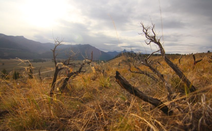
Beyond Silver Gate our pace was frequently slowed by the bizarre presence of cows alongside the highway. They were each earmarked, so they plainly belonged to someone, but were lounging and grazing beside the road. There was a fork in the highway and a turnout on the high road, which we stopped at. More plains in front of mountains that could have stood in for Mordor in the films. Returning to our car, a young woman pulled over and, with no introduction, spontaneously asked me for directions. I explained I wasn’t local, but we offered her the use of our maps.
“If we were local, we wouldn’t have stopped at the overlook,” my dad chuckled after she left.
“And if we were local and stopped at the overlook… watch out,” I added.
A sign along the highway explained the continued presence of the cows, “CAUTION: OPEN RANGE / EXPECT LIVESTOCK IN ROADS.” We were apparently in a region where it’s perfectly legal to simply turn one’s cattle loose. We saw another sign for an NFS lookout tower on one of the mountains and turned in to take a look. A sign stated the tower was closed by the time we arrived, but the summit would still be available. I slowly lurched the car up the steep switchbacks leading to the top of the mountain. “At least there will be no more cows up here,” I remarked. More steep slopes and tight switchbacks. The trees began to vanish. And there was… a cow. In the middle of the road. On the side of the mountain. By this point we had climbed for perhaps twenty five minutes and with a finite amount of daylight left and at least three more long switchbacks above us, we decided to just turn around.
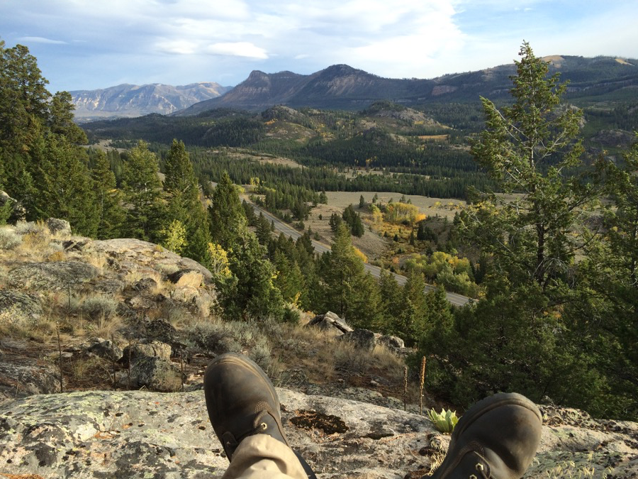
Between Yellowstone NP and Red Lodge is the Beartooth Pass, which is marked on the map with some squiggly lines. I figured this would have been the easiest route around the bases of the mountain as determined by a few surveyors at least a century ago. Much earlier in Mordor, Dad told me someone coming in the opposite direction had called the road “hairy.” We were somewhat unimpressed by the road’s hairiness so far and wrote it up as being a problem for RVers and their huge wheelbases. But as we went on, the road routed itself along precipices with spectacular drops. The scenery was rewarding though, as we pushed back into the forest and were treated to alpine ponds and wooded cliffs.
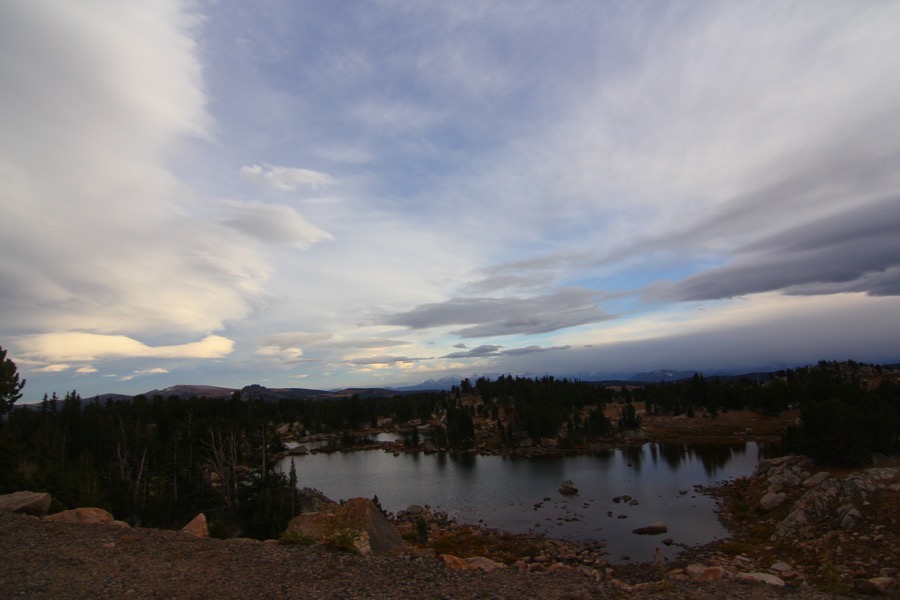
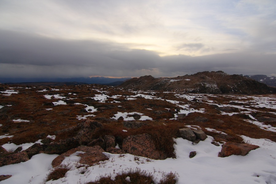
Higher we went and with the altitude, the trees became less dense. Colorful mountain meadows, some with the occasional guest ranch, took over from the trees. Daylight would be ending soon, but surely we would be descending again and would be near Red Lodge. This was the “Beartooth Pass” after all, not the “Beartooth Summit Road.” Higher still we went. Winds picked up and patches of snow were on the ground. There were no more dude ranches. The treeline was a memory beneath us and the grassy meadows were displaced by exposed rock with hardly any topsoil. More snow.
And higher still.
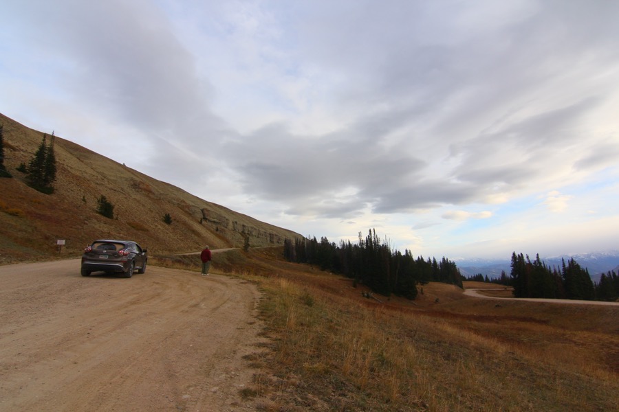
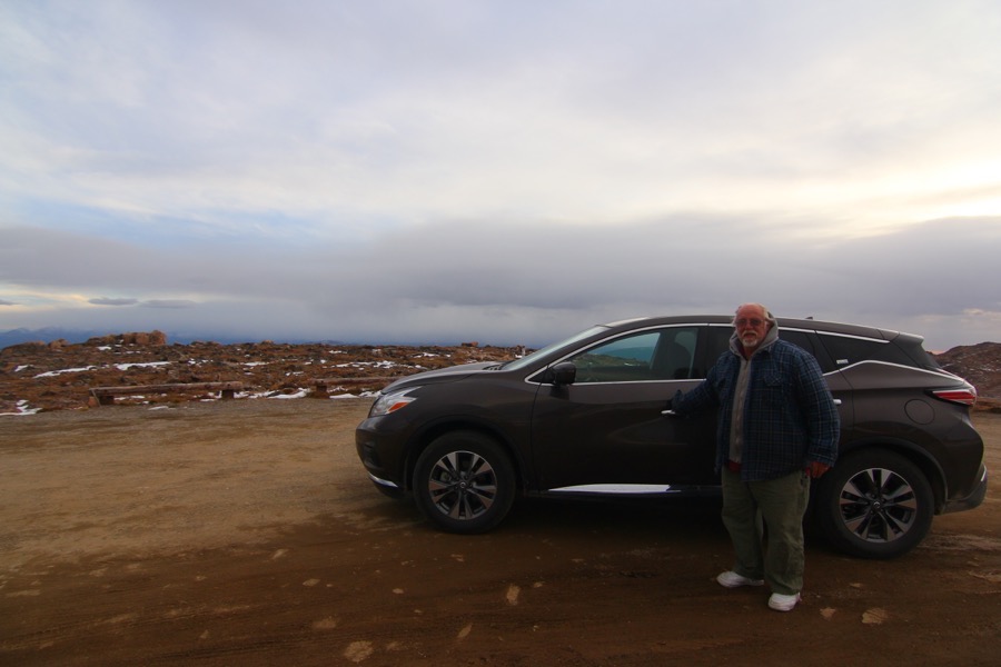
It felt like an accomplishment when a sign marked the path to the summit, a small dirt road providing a few feet more elevation a couple of hundred yards away. “That’s for idiots who want to drive higher,” Dad said. So we drove up. We took pictures. We still had a drive down.
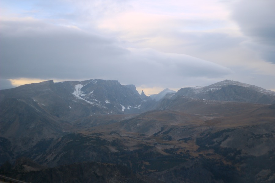
For some distance we rode along the top of the mountains. A motor home could be seen parked in the middle of one of the rocky alpine meadows, with no apparent easy route from the road. In derangement of highway panning, the speed limit briefly reached 70 miles per hour, though we refused to go above 40, and the limit quickly came back down. Opposite the valley beneath us were another line of summits. These peaks took the outline of roughly sharpened edges and abstract weapons, as though the stone was revolting and setting to conquer the domain of the sky above in its last minutes of light. A natural stone spire, set upon bare sky and framed by slopes around it, struck upward. This had to be the Bear Tooth itself.
The road traced its way down, loosely unwound across the wall that formed the face of a mountain that had no anticipation of accommodating travelers when it rose from the Earth. Looking down, I measured a lone pine tree on the valley floor below and estimated we had something like a mile of vertical distance to cover.
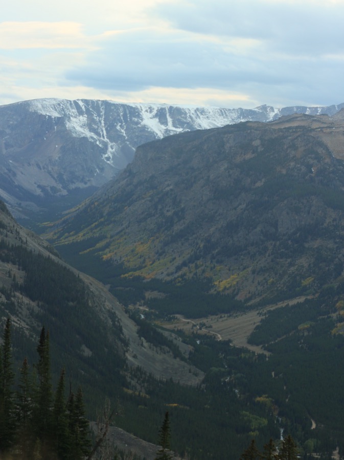
And we joined those trees as the day darkened. We passed a number of campsites, but dismissed them as possibilities and proceeded directly to Red Lodge. Well-to-do houses began appearing again. I looked back at the valley we entered and the mountains that wanted their own place in the sky. I’ve never been to Yosemite Valley, but its promises were made by the sight of these mountains, noted with no more than a zigzag on the map. A touching secret. And all we had done was drive up and down a public road.
We were directed onto the town’s main street and rolled out onto the strip. People walked the sidewalk here and there. Groups were gathered outside the more popular bars and restaurants and happy chatter. Storefronts closed for hours made promises to the prospective consumer for the following day. We got out and walked around, checking out property prices in the window at the real estate office, before selecting our restaurant for dinner. I munched on my reuben sandwich and the cheerful waitress asked if there was anything else she could do for us. “Nothing, unless you can give us a campsite,” Dad joked. With the check, she came back with information she had collected on local campgrounds. We tipped extra and made another round of the streets. I noted an old movie theater converted into a candy shop. It had beautiful old burlesque feel to it in the night.
We drove out of town, having selected another KOA site. We dropped our money into the night collection box and settled in to what looked like a schoolyard full of RVs and camping trailers. It wasn’t beautiful, but it was space for our tents.
Thoroughly enjoying this.